CartoDruid - GIS offline tool 0.62.4
Free Version
Publisher Description
CartoDruid - GIS offline tool - A GIS tool developed by ITACyL to support fieldwork
CartoDruid is a GIS application developed by the Instituto Tecnológico Agrario de Castilla y León (ITACyL), designed as a tool to support fieldwork. It addresses the challenge of offline editing of georeferenced information.
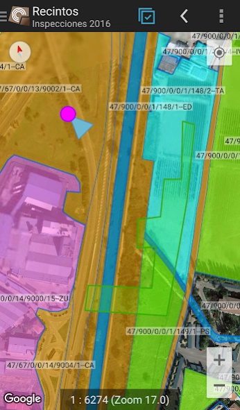
In many field areas with insufficient mobile coverage, CartoDruid provides a reliable solution by enabling visualization of raster and vectorial layers stored on the device. It allows the creation of new geometries (entities) by drawing them directly on the screen or using embedded or external GPS.
CartoDruid is user-friendly and doesn’t require previous GIS knowledge, making it easy to configure and use for anyone managing fieldwork information. Data generated can be exported for use in external applications.
Features of CartoDruid include:
Visualization of online Google Maps.
Usage of vectorial cartography in a SpatiaLite database.
Raster imagery support from a RasterLite database.
Online WMS services consumption.
Creation and configuration of new layers on the device.
Filtering, symbologies, labeling, searching, and identification forms based on SQL queries.
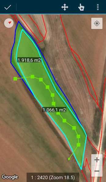
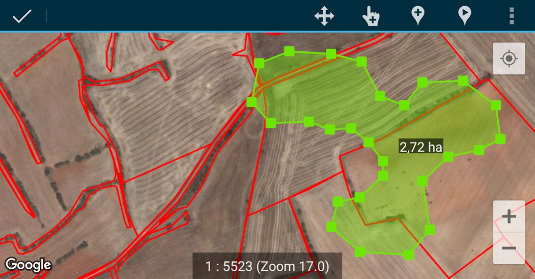
Editing attributes and manual drawing of geometries.
GPS-based drawing and editing of geometries.
Advanced geometry editing tools.
Data saving features, including georeferenced data and associating pictures to entities.
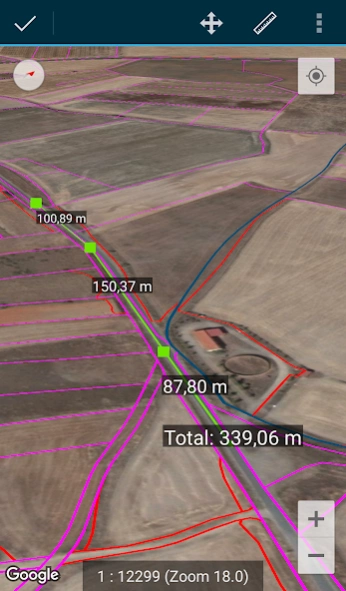
Additional tools like SIGPAC search, measurement tools, navigation aids, bookmarks management.
Import and export functionalities in multiple formats.
TOC management and SHP file support as an experimental feature.
Layer operation controls.
CartoDruid uses background location services for creating features based on location tracking. User location is only used for creating geometry vertices or map positioning, with data stored locally and not sent outside the device. Project folder deletion allows for easy data removal.
For a complete list of features, downloadable examples, and starting guides, visit www.cartodruid.es.
About CartoDruid - GIS offline tool
CartoDruid - GIS offline tool is a free app for Android published in the System Maintenance list of apps, part of System Utilities.
The company that develops CartoDruid - GIS offline tool is Instituto Tecnológico Agrario de Castilla y León. The latest version released by its developer is 0.62.4.
To install CartoDruid - GIS offline tool on your Android device, just click the green Continue To App button above to start the installation process. The app is listed on our website since 2024-03-13 and was downloaded 1 times. We have already checked if the download link is safe, however for your own protection we recommend that you scan the downloaded app with your antivirus. Your antivirus may detect the CartoDruid - GIS offline tool as malware as malware if the download link to es.jcyl.ita.crtdrd is broken.
How to install CartoDruid - GIS offline tool on your Android device:
- Click on the Continue To App button on our website. This will redirect you to Google Play.
- Once the CartoDruid - GIS offline tool is shown in the Google Play listing of your Android device, you can start its download and installation. Tap on the Install button located below the search bar and to the right of the app icon.
- A pop-up window with the permissions required by CartoDruid - GIS offline tool will be shown. Click on Accept to continue the process.
- CartoDruid - GIS offline tool will be downloaded onto your device, displaying a progress. Once the download completes, the installation will start and you'll get a notification after the installation is finished.
